Suche Über BKG-MIS
Kontakt Impressum Datenschutz Erklärung zur Barrierefreiheit
BKG-MIS - Indexieren, Recherchieren, Visualisieren, Teilen
Metadaten
Informations
System
Suche
Über BKG-MIS
Alle Suchergebnisse
Geodatensatz
INSPIRE
Opendata

INSPIRE Geographical Names GN250

Inhalt
  • Übersicht
  • Be­schrei­bung
    Zeitbezug der Daten Zeitbezug
  • Raumbezug
  • Verweise und Downloads
    Querverweise Weitere Verweise
  • Nutzung
  • Kontakt
    Ansprechpartner Vertrieb Eigentümer
  • Fach­infor­mationen
    Informationen zur Geodatenressource Zusatzinformationen Schlag­worte
  • Metadatensatz

Querverweise (2)

INSPIRE-WFS Geographical Names GN250
INSPIRE Direct Access Download Service for geographical names of municipalities or parts thereof, landscapes, mountain ranges, mountains, islands, rivers, canals, lakes, seas, etc. Data is provided for the Federal Republic of Germany. The dataset is structured according to the INSPIRE Annex I Theme - Geographical Names. The selection of the geographical names is based on the map scale 1:250.000. and is derived from different statistical sources, Digital Landscape Models 1:250.000 (DLM250) and Digital Elevation Model grid width 10 m (DGM10). This service is published under the Ordinance to Determine the Conditions for Use for the Provision of Spatial Data of the Federation (GeoNutzV) and thereof free of charge.
WMS
INSPIRE-WMS Geographical Names GN250
INSPIRE View Service for geographical names of municipalities or parts thereof, landscapes, mountain ranges, mountains, islands, rivers, canals, lakes, seas, etc. Data is provided for the Federal Republic of Germany. The dataset is structured according to the INSPIRE Annex I Theme - Geographical Names. The selection of the geographical names is based on the map scale 1 : 250 000. and is derived from different statistical sources, Digital Landscape Models 1 : 250 000 (DLM250) and Digital Elevation Model grid width 10 m (DGM10). This service is published under the Ordinance to Determine the Conditions for Use for the Provision of Spatial Data of the Federation (GeoNutzV) and thereof free of charge.

Nutzungs­bedingun­gen

This data may be used without restriction and free of charge pursuant to the Ordinance for the Establishment of the Conditions of Use regarding the Provision of Federal Spatial Data (Verordnung zur Festlegung der Nutzungsbestimmungen für die Bereitstellung von Geodaten des Bundes – GeoNutzV) as published on March 19, 2013 (Bundesgesetzblatt Jahrgang 2013 Teil I Nr. 14). For more details see: https://sg.geodatenzentrum.de/web_public/gdz/lizenz/eng/geonutzv.pdf. Please include the required reference to the source when using the data.

Ansprechpartner

Federal Agency for Cartography and Geodesy service centre

dlz@bkg.bund.de
+49 (0)341 5634-333
+49 (0)341 5634-415
https://www.bkg.bund.de

Vorschau

img

overview

Be­schrei­bung

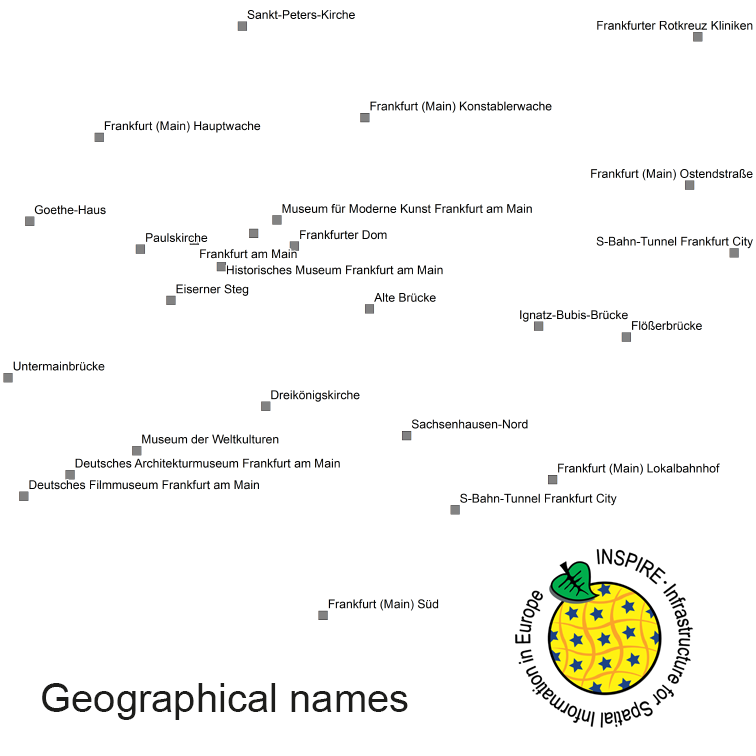
The INSPIRE-conform dataset geographical names Germany is the base for an INSPIRE-conform Web Feature Service (WFS) and Web Map Services (WMS). The dataset includes all relevant feature types from the digital landscape model scale 1:250.000 (DLM250): settlements, transportation, vegetation, hydrography, areas and regions with attributes regarding position (geometry data from DLM250), status and language of the geographical name.

Status

kontinuierliche Aktualisierung

Periodizität

jährlich

Zeitbezug

Erstellung

15.11.2015

Letzte Änderung

19.12.2018

Raumbezug

Lage der Geodaten (in WGS84)
SW Länge/Breite NO Länge/Breite
Bundesrepublik Deutschland 6.098034°/47.23942° 15.578555°/55.054344°
Administrative Einheit (Gemeindenummer)

Bundesrepublik Deutschland

Koordinaten­system
EPSG 4258: ETRS89 / geographisch
EPSG 32632: WGS 84 / UTM Zone 33N
EPSG 32632: WGS 84 / UTM Zone 32N
EPSG 25833: ETRS89 / UTM Zone 33N
EPSG 25832: ETRS89 / UTM Zone 32N
EPSG 31469: DHDN / Gauss-Krüger Zone 5
EPSG 31468: DHDN / Gauss-Krüger Zone 4
EPSG 31467: DHDN / Gauss-Krüger Zone 3
EPSG 31466: DHDN / Gauss-Krüger Zone 2
EPSG 4326: WGS 84 / geographisch

Verweise und Downloads

Querverweise (2)

Geodatendienst
INSPIRE-WFS Geographical Names GN250
img
INSPIRE Direct Access Download Service for geographical names of municipalities or parts thereof, landscapes, mountain ranges, mountains, islands, rivers, canals, lakes, seas, etc. Data is provided for the Federal Republic of Germany. The dataset is structured according to the INSPIRE Annex I Theme - Geographical Names. The selection of the geographical names is based on the map scale 1:250.000. and is derived from different statistical sources, Digital Landscape Models 1:250.000 (DLM250) and Digital Elevation Model grid width 10 m (DGM10). This service is published under the Ordinance to Determine the Conditions for Use for the Provision of Spatial Data of the Federation (GeoNutzV) and thereof free of charge.
WMS
Geodatendienst
INSPIRE-WMS Geographical Names GN250
img
INSPIRE View Service for geographical names of municipalities or parts thereof, landscapes, mountain ranges, mountains, islands, rivers, canals, lakes, seas, etc. Data is provided for the Federal Republic of Germany. The dataset is structured according to the INSPIRE Annex I Theme - Geographical Names. The selection of the geographical names is based on the map scale 1 : 250 000. and is derived from different statistical sources, Digital Landscape Models 1 : 250 000 (DLM250) and Digital Elevation Model grid width 10 m (DGM10). This service is published under the Ordinance to Determine the Conditions for Use for the Provision of Spatial Data of the Federation (GeoNutzV) and thereof free of charge.

Weitere Verweise (2)

Dienst "INSPIRE-WFS Geographical Names GN250" (GetCapabilities) Information
Dienst "INSPIRE-WMS Geographical Names GN250" (GetCapabilities) Information

Nutzung

Nutzungs­bedingun­gen

This data may be used without restriction and free of charge pursuant to the Ordinance for the Establishment of the Conditions of Use regarding the Provision of Federal Spatial Data (Verordnung zur Festlegung der Nutzungsbestimmungen für die Bereitstellung von Geodaten des Bundes – GeoNutzV) as published on March 19, 2013 (Bundesgesetzblatt Jahrgang 2013 Teil I Nr. 14). For more details see: https://sg.geodatenzentrum.de/web_public/gdz/lizenz/eng/geonutzv.pdf. Please include the required reference to the source when using the data.

© GeoBasis-DE / BKG (year of last data download)

Zugriffs­beschränkun­gen

Es gelten keine Zugriffsbeschränkungen

Kontakt

Ansprechpartner

Federal Agency for Cartography and Geodesy service centre

Karl-Rothe-Str. 10-14
04105 Leipzig
Deutschland

dlz@bkg.bund.de
+49 (0)341 5634-333
+49 (0)341 5634-415
https://www.bkg.bund.de
Vertrieb

Federal Agency for Cartography and Geodesy service centre

Karl-Rothe-Str. 10-14
04105 Leipzig
Deutschland

dlz@bkg.bund.de
+49 (0)341 5634-333
+49 (0)341 5634-415
https://www.bkg.bund.de
Eigentümer

Federal Agency for Cartography and Geodesy

Richard-Strauss-Allee 11
60598 Frankfurt am Main
Deutschland

mailbox@bkg.bund.de
+49 (0)69 6333-1
+49 (0)69 6333-235
https://www.bkg.bund.de

Fach­infor­mationen

Informationen zur Geodatenressource

Identifikator

https://registry.gdi-de.org/id/de.bund.bkg.csw/DEBKG00M00000187

Digitale Repräsentation

Vektor

Erstellungs­maß­stab
Maßstab 1:x Boden­auf­lösung m Scan­auf­lösung dpi
300000
150000
Fachliche Grundlage

Transformation from national name database into INSPIRE. Sources: Geographisches Namenbuch Bundesrepublik Deutschland, IfAG 1981, Ergänzung 1991 bis 1996 Auswahl der Namen: Übersichtskarten 1:500.000, 1:250.000, 1:25.000

Herstellung­sprozess

Transformation from national name database into INSPIRE

Zusatzinformationen

Sprache des Daten­satzes

Dänisch

Niedersorbisch

Friesisch

Deutsch

Obersorbisch

Sorbisch

Kon­formi­tät
Spezifi­kation der Kon­formi­tät Spezifi­kations­datum Grad der Kon­formi­tät Geprüft mit
INSPIRE Data Specification on Geographical Names- Guidelines 17.04.2014
COMMISSION REGULATION (EU) No 1089/2010 of 23 November 2010 implementing Directive 2007/2/EC of the European Parliament and of the Council as regards interoperability of spatial data sets and services 08.12.2010
Datenformat
Name Version Kompressionstechnik Spezi­fikation
GML 3.2

Schlag­worte

INSPIRE-Themen Geografische Bezeichnungen
INSPIRE - Räumlicher An­wen­dungs­bereich National
GEMET-Concepts hospital mountain watercourse
AdV-Produktgruppe Digitale Landschaftsmodelle
ISO-Themen­kategorien Ortsangaben
Suchbegriffe administrative units AdVMIS hydography important buildings inspireidentifiziert names opendata settlement names

Informationen zum Metadatensatz

Objekt-ID

142d56bb-108b-4e6a-96a6-8239b80af77e

Datum

08.06.2022

Sprache Metadatensatz

Englisch

Datensatz / Datenserie  

Datensatz

XML Dar­stellung
Metadaten als XML herunter­laden
Ansprechpartner (Metadatum)
dlz@bkg.bund.de

Diese Seite

  • drucken
  • empfehlen

Service

  • Twit­ter
  • Lin­ke­dIn
  • Ins­ta­gram
  • Xing
  • You­tu­be
  • RSS
BKG
  • Kontakt
  • Impressum
  • Datenschutz
  • Erklärung zur Barrierefreiheit

© Bundesamt für Kartographie und Geodäsie - 2022

Hilfe

NUMIS NUMIS
UVP UVP